
Waterfall Name: Honeoye Lower Falls
Aka: ————-
Location: Honeoye Falls
First Visit: 08-12-2013
State: New York State
Region: Western Region
County: Monroe County
Park Area: Harry Allen Park
NYS Tourism Region: Finger Lakes-Wine Country
NYDEC Region: Western Finger Lakes
Waterfall Challenge: ————-
Waterfall Location: N42.95325 W77.58776
Parking: N42.953530 W77.589278
Trailhead: N42.953387 W77.588352
Trail Name, Reference to: gps approx for trailhead, Zebulon Norton Trail Red Sawmill
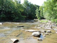
Stream, River: Honeoye Creek
Height, Type: 6ft
Elevation: 625 ft
Level of Difficulty, Hiking Distance: Short, .5 mile rt
Whitewater Rte, Canoe Rte Map: ————-
Maps: Western New York All-Outdoors Atlas & Field Guide, 2008,C5,pg129
My Resource: 200 Waterfalls in Central and Western New York: A Finder’s Guide Paperback – June 5, 2018, by Rich and Sue Freeman,Waterfalls in Monroe, Livingston and Ontario Counties,pg112
Book Resource: 200 Waterfalls in Central and Western New York: A Finder’s Guide Paperback – June 5, 2018, by Rich and Sue Freeman,Waterfalls in Monroe, Livingston and Ontario Counties,pg112
Brochures, Travel Guides, Visitor Guides: ————-
Trail_URL: ————-
Additional Information: Nyfalls
Photos, Information Contributed to other Websites: ————-
Landmark: Village of Honeoye Falls, Tompkinson, Kenyon & Tompkinson Dam N42.95334 W77.58778
Nearest Intersection: North Main Street (Route 65) and Monroe Street and W Main Street
Directions: From I-90 W in Henrietta, Take exit 46 to the right onto I-390 towards Rochester/Corning and drive for .4 miles. Take the I-390 S ramp to the right towards Corning and drive for 3.1 miles. Take exit 11 to the right onto Rt-15 towards Rt-251/Rush/Scottsville and drive for .3 miles. Take ramp to the left towards Rt-251 W for 207 ft. Turn left onto W Henrietta Rd and drive for .3 miles. Turn left onto Rush Scottsville Rd and drive for 1.3 miles. Turn right onto E Henrietta Rd and drive for .3 miles. Bear left onto Rush Lima Rd and drive for 3 miles. Turn left onto Monroe St. and drive for 1.6 miles. Turn left onto N Main St. for 212 ft.
Comments, Notes: From the parking you need to go all the way to the back of the park for the trail.
————-
————-
————-