
Waterfall Name: Hume Upper Falls
Aka: ————-
Location: Hume Twn
First Visit: 08-12-2013
State: New York State
Region: Western Region
County: Allegany County
Park Area: ————-
NYS Tourism Region: Chautauqua-Alleghany
NYDEC Region: Western New York
Waterfall Challenge: ————-
Waterfall Location: N42.47339 W78.1367
Parking: N42.47364 W78.13616
Trailhead: N42.47364 W78.13616
Trail Name, Reference to: ————-
Stream, River: Cold Creek
Height, Type: 30ft,total (Upper 20ft,Lower 10ft)
Elevation: 1250 ft
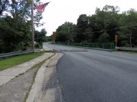
Level of Difficulty, Hiking Distance: Private/View from bridge
Whitewater Rte, Canoe Rte Map: ————-
Maps: ————-
My Resource: 200 Waterfalls In Central And Western New York By Rich And Sue Freeman
Book Resource: ————-
Brochures, Travel Guides, Visitor Guides: ————-
Trail_URL: ————-
Additional Information: ————-
Photos, Information Contributed to other Websites: ————-
Landmark: ————-
Nearest Intersection: Hume and Rte 19 and Liberty St
Directions: From I-90 W in Batavia, Take exit 48 to the right onto Rt-98 towards Batavia and drive for .9 miles. Turn left onto Hwy 98 and drive for 1.2 miles. Enter roundabout Roundabout for 245 ft. Take the 3rd right onto Hwy 98 and drive for 10.1 miles. Turn left onto Prospect St and drive for .6 miles. Turn left onto Main St and drive for 1 miles. Bear right onto Halls Corners Rd and drive for 16.1 miles. Turn left onto Dolph Rd and drive for .1 miles. Turn right onto Hardys Rd and drive for 5.3 miles. Turn left onto Hwyy 39 and drive for 1.2 miles. Turn right onto N Water St and drive for .8 miles. Turn right onto Main St and drive for .2 miles. Turn left onto Spencer St and drive for 6.1 miles. Turn right onto Cr-23 and park anywhere there is parking.
Comments, Notes: ————-
————-
————-
————-
