
Waterfall Name: Katrina Falls
Aka: ————-
Location: Thompson Twn
First Visit: 08-23-2014
State: New York State
Region: Southern Region
County: Sullivan County
Park Area: ————-
NYS Tourism Region: Catskill Mountains
NYDEC Region: Lower Hudson Valley
Waterfall Challenge: ————-
Waterfall Location: N41.60713 W74.61976
Parking: N41.60817 W74.61666
Trailhead: ————-
Trail Name, Reference to: ————-
Stream, River: Davies Lake Outlet
Height, Type: 90ft,Horsetail
Elevation: 1143 ft
Level of Difficulty, Hiking Distance: ————-
Whitewater Rte, Canoe Rte Map: ————-
Maps: Eastern New York all outdoors Atlas and Field Guide Publication 2008,A6,pg163
My Resource: Eastern New York all outdoors Atlas and Field Guide Publication 2008,A6,pg163
Book Resource: ————-
Brochures, Travel Guides, Visitor Guides: ————-
Trail_URL: ————-
Additional Information:
Photos, Information Contributed to other Websites: Dig the Falls
Landmark: ————-
Nearest Intersection: Katrina Falls Rd and Rte 173
Directions: From I-84 W near Wallkill Twn, Take exit 4W to the right onto Rt-17 W towards Binghamton and drive for 20.7 miles.Take exit 109 to the right towards Rock Hill/Woodridge and drive for .2 miles. Turn right onto Rock Hill Dr for 437 ft. Turn right onto Katrina Falls Rd and drive for 1.8 miles.
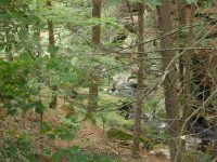
Comments, Notes: This waterfall is completely and totally not accessable. Spoke with the homeowner and he was very stern about no trespassing.
————-
————-
————-
