
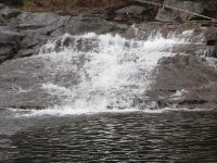
Waterfall Name: Calamity Brook, Falls on
Aka: Calamity Brook, Falls on First Bridge With Waterfall
Location: Newcomb Twn
First Visit: 10-15-2008
State: New York State
Region: Northern Region
County: Essex County
Park Area: ————-
NYS Tourism Region: Adirondack Mountains
NYDEC Region: Eastern Adirondacks/Lake Champlain
Waterfall Challenge: ————-
Waterfall Location: N44.100230 W74.043890
Parking: N44.08916 W74.05640
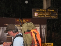
Trailhead: N44.11318 W73.99326
Trail Name, Reference to: ————-
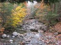
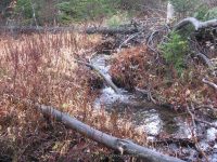
Stream, River: Calamity Brook
Height, Type: ————-
Elevation: 1925 ft
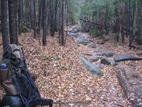
Level of Difficulty, Hiking Distance: 1.2 mile 1-way
Whitewater Rte, Canoe Rte Map: ————-
Maps: ————-
My Resource: Hike
Book Resource: Adirondack Waterfall Guide: New York’s Cool Cascades Paperback – September 1, 2003, by Russell Dunn,, C. Russell Dunn,III. Falls Along The Adirondack Northway, Adirondack Norway,pg175
Brochures, Travel Guides, Visitor Guides: ————-
Trail_URL: ————-
Additional Information: Russell Dunn
Photos, Information Contributed to other Websites: ————-
Landmark: ————-
Nearest Intersection: Upper Works Rd and Santanoni Rd
Directions: From I-87 N South of North Hudson, Take exit 29 to the right towards Newcomb/North Hudson and drive .2 miles. Turn left onto Blue Ridge Rd and drive 17.6 miles.Turn right onto Tahawus Rd and drive .4 miles. Turn left onto Tahawus Rd and drive another 5.9 miles. Turn left onto Upper Works Rd and drive 3.5 miles to the parking area and trailhead.
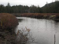
Comments, Notes: David Henderson Monument N44.11242 W73.99913 Dam N44.10784 W73.99085 Cliffside Shots N44.10168 W73.99075 Calamity Brook Photos N44.10748 W74.02035 First Bridge With Waterfall N44.10014 W74.04356 Henderson Lake Photo N44.09337 W74.05734 Livingston Point Lean To Photo N44.11259 W73.98897 High Water Bridge N44.10689 W74.02121 Mr Snake N44.10219 W73.99024 On High Water Bridge N44.10730 W74.02047 Our Lean To N44.11123 W73.99210 Second Bridge N44.10175 W74.03602 State Land Boundry Sign N44.10254 W74.02556 Strip Mine N44.04540 W74.05067 Lean to photo N44.11331 W73.98970 Trail Sign-parking Area Sign N44.09388 W74.05698 Trail Turnaround N44.10089 W73.99034 Trailhead Register N44.11318 W73.99326 Walkbridge Photo N44.09217 W74.05800 Hanging Spears Falls Overlook N44.10152 W73.99077 Waterfall Photos N44.10075 W74.02988 Waterfall Photos N44.10621 W73.99073
Sign in at trail head to state boundry sign
————-
