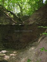
Waterfall Name: Mount Hope Falls and Reservoir
Aka: ————-
Location: Oneida
First Visit: 05-13-2012
State: New York State
Region: Central Region
County: Madison County
Park Area: Mount Hope Park
NYS Tourism Region: Central Leatherstocking
NYDEC Region: Central New York
Waterfall Challenge:————-
Waterfall Location: N43.06021 W75.65162
Parking: N43.05841 W75.64169
Trailhead: ————-
Trail Name, Reference to: ————-
Stream, River: Unnamed Stream
Height, Type: ————-
Elevation: 675 ft
Level of Difficulty, Hiking Distance: ————-
Whitewater Rte, Canoe Rte Map: ————-
Maps: https://www.madisoncounty.ny.gov/planning/trails
My Resource: Madison County Trails
Book Resource: ————-
Brochures, Travel Guides, Visitor Guides: https://www.madisoncounty.ny.gov/planning/trails
Trail_URL: ————-
Additional Information: ————-
Photos, Information Contributed to other Websites: Dig the Falls
Landmark: ————-
Nearest Intersection: Mount Hope Ave and Hwy 46
Directions: From I-90 W, in Verona, Take exit 33 to the right onto Rt-365 towards Verona/Oneida and drive for .9 miles. Keep left onto Rd ramp and drive for .2 miles. Turn left onto Hwy 365 W and drive for 3.8 miles. Turn right onto Seneca Ave and drive for .4 miles. Turn left onto Glenwood Ave and drive for 1.6 miles. Turn right onto Mt Hope Ave and drive for .5 miles.
Comments, Notes: The Mount Hope trail map indicates there is a waterfall here, but this was all I found.
————-
————-
————-


